
A Picture is Worth 1,000 Words: Measuring Core GDP from Outer Space
Atlas Analytics' Weekly Subscriber Update

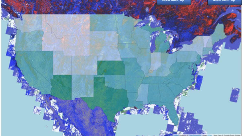
Picture of ROY’s Algorithm in Practice: This picture shows the change in the built environment for Quarter 4, 2015 utilizing the ROY remote sensing algorithm. This picture is then translated into a proprietary numerical dataset by state, and combined with traditional economic data in order to predict Core GDP in real time. This image demonstrates that Texas, Arizona and, surprisingly, Kansas had some of the strongest growth in urbanicity during this period.
Source: NASA, USGS, Atlas Analytics’ analysis
They say a picture is worth 1,000 words.
At Atlas Analytics, we use satellite pictures from outer space to track economic activity in real time. By ingesting raw images of Earth from the Landsat Program (a series of satellites continuously monitoring the planet as a joint venture between NASA and the US Geological Survey), we utilize our Remote Orbital Yield (ROY) algorithm to extract information from the physical environment, translate these statistics into numerical data, and use machine learning and AI to make a mathematical bridge between the past satellite data and previous GDP values.
The result: Our team can then utilize this past mathematical bridge to predict current GDP using the real-time Landsat images of Earth.
As opposed to other economic institutions and legacy forecasters who use outdated data and their intuition to make predictions about future economic performance, Atlas Analytics uses real, live pictures of Earth to make inferences about true economic activity ahead of everyone else.
The difference is that, rather than guessing about future economic activity, Atlas Analytics utilizes science to innovate a new methodology for forecasting what is actually happening based on true pictures of economic development.
We’re often asked: “What does the algorithm look for in the satellites? Is it nightlights?”
